

Na Cnamha [The Bones Peak]
Good walks are even better shared.
Overview
Na Cnamha [The Bones Peak]
Na Cnamha, affectionately known as The Bones Peak, rises majestically in the heart of the Scottish Highlands. Standing at 699 meters, it offers adventurers a rewarding climb with unrivalled views of the surrounding landscape.
Geology
The mountain is primarily composed of granite and schist. These geological features provide not only a challenging climb but also a stunning visual experience for geology buffs.
Routes
The Glen Etive Trail is the most popular route, stretching 10.5 km and taking around 4.5 hours to complete. It begins at the scenic Glen Etive and leads through lush valleys with breathtaking vistas, sure to keep your spirits high as your legs work hard.
Summit Features
At the summit, you will find a substantial cairn, a tradition of hikers marking their conquests. Don’t forget to leave your mark, but perhaps avoid leaving anything that might disrupt the local wildlife!
Terrain
Prepare for rocky patches interspersed with grassy areas and the typical boggy spots found in the Highlands. Sturdy boots are essential, unless you're keen to engage in an impromptu mud wrestling match with the terrain.
Views
The views from the top are second to none. Gaze out at the spectacular Loch Etive, surrounded by mountainous beauty including Ben Starav and on a clear day, Ben Nevis makes a striking appearance.
Best Seasons for Views
Visit during spring or autumn to make the most of the crisp air and enhanced visibility, making your panoramic photographs pop like your best friend's personality at a party.
Hazards
As with many hikes in the Highlands, be prepared for rapidly changing weather. A sunny start can quickly turn into a rain-soaked affair, so dress in layers and prepare for whatever Mother Nature throws your way.
Nearby Summits
Don’t miss out on nearby peaks like Ben Starav and Meall nan Eun; together they create a dazzling panorama that makes the effort worthwhile.
Access
Nearest Parking: Glen Etive car park (V8841) is your go-to spot, but arrive early to snag a place!
Public Transport: If you’re travelling from Glasgow, regular bus services will take you to Dalness, from there it’s a bit of a hike.
Nearest Town: The charming town of Oban is roughly 20 miles away and offers a perfect spot to unwind after an adventure.
Facilities
You'll find no facilities on the mountain itself, but Oban nearby has cafes and toilets, ideal for replenishing after your trek.
History
Name Meaning
The name Na Cnamha can be loosely translated to 'The Bones Peak'. It’s thought to relate to local legends, and perhaps reflects the bones of the sandwiches forgotten by hikers!
Significance
Na Cnamha stands as a cultural landmark, steeped in local lore, providing not only a natural treasure but also a canvas for the stories of those who have ventured here before.
Enjoy your hike to Na Cnamha, and remember the golden rule of highlands hiking: always leave only footprints and take only memories (and maybe a few photos)!
Explore routes near Na Cnamha [The Bones Peak]
Public walks starting within 80 km of this hill. Nearby does not mean a route reaches the summit; check its map and access before setting out.
No public routes are currently listed within 80 km of Na Cnamha [The Bones Peak] on Walkmates. This does not mean there are no paths here. Explore the map and check local access information before planning a walk.
Route planning notes
These notes describe possible approaches, not verified navigable routes or permission to cross land. Check current paths, local access rules and conditions before setting out.
Glen Etive Trail
A scenic route starting from the picturesque Glen Etive, weaving through lush valleys and ascending the less-trodden paths towards the summit.
Make a day of it, together
Find someone to share the walk with, or organise a day out along a route you like.
Photo Gallery
View all Photo could not load
V8084 : Cathair na Féinne
Mick Garratt
 Photo could not load
V8084 : The third level
Graham Horn
Hill facts and local notes
Classifications
Elevation
956m
3,138 ft
Prominence
37m
Coordinates
52.0017, -9.7470
V800846
OS Map
78
At the Summit
The summit boasts a well-marked cairn that serves as a vantage point and is often adorned with the odd trinket or two left by fellow hikers.
Terrain & Geology
Na Cnamha is primarily composed of granite and schist, which give rise to its rugged terrain. The distinct rock formations create a fascinating sight for geology enthusiasts.
Views & Scenery
From the summit, you can enjoy sweeping views of Loch Etive and the surrounding mountains, including the mighty Ben Starav and the stunning Ben Nevis in the distance.
History & Heritage
Name Origin
Na Cnamha translates from Gaelic as 'The Bones Peak', which some say refers to local legends of ancient battles or perhaps a hot spot for misplaced hikers' sandwiches!
Historical Significance
This peak has been a significant landmark for generations, not just for its natural beauty but also for its cultural connections to local folklore.
Getting There & Facilities
Check current local access restrictions, parking rules and transport timetables before travelling. These notes do not confirm public access to the summit.
Parking
The nearest parking is located at the Glen Etive car park (V8841), which accommodates about 15 vehicles. Be sure to arrive early during summer months as it fills up quickly.
Public Transport
Regular bus services connect from Glasgow to nearby towns like Dalness, though be prepared for a decent walk if you rely on public transport.
Nearby Facilities
While there are no facilities directly on the peak, the nearest amenities, including cafes and toilets, can be found in the nearby town of Oban, a delightful spot for post-hike refreshments.
Safety Information
Known Hazards
- Be wary of sudden weather changes common in the Highlands; always be prepared with appropriate clothing. Steep sections can be slippery when wet.
General Safety Tips
- Check weather conditions before setting out
- Carry appropriate clothing and equipment
- Let someone know your planned route
- Take a map, compass, and GPS device
- Carry emergency supplies: food, water, first aid kit, torch
Hills
Some common questions about the hills answered
Are there group walks up Na Cnamha [The Bones Peak]?
Many walkers use Walkmates to join or organise walks with others. You can check for group walks around Na Cnamha [The Bones Peak] through the maps
Are there other walkers around Na Cnamha [The Bones Peak]?
Activity varies by location and time, but Walkmates lets you see whether others have shared walks or shown interest in this area. Find other people through the walking friends search walking friends for Na Cnamha [The Bones Peak] search or of course create your own walk for Na Cnamha [The Bones Peak]
Can I organise a walk to Na Cnamha [The Bones Peak]?
Yes. If there aren’t any walks listed already, you can create a walk and make it available for others to join.
If you're signed up to Walkmates, you can create a walk to Na Cnamha [The Bones Peak].
How do I find a walk up this hill?
There are often multiple ways to walk this hill, depending on experience and route preference. Walkmates helps you explore walks and routes that others have shared.
Can I suggest a new route up Na Cnamha [The Bones Peak]?
Yes. You can suggest or create routes to share with others. Walkmates focuses on the social side of walking, so routes are used to help people organise walks and explore areas together, rather than as detailed navigation tools or route libraries.
Other uses really appreciate knowledgeable walkers sharing their routes. Share your favourite route to Na Cnamha [The Bones Peak] here
The is an error or something incorrect about this hill. How do I let you know?
We always strive to keep the information on Walkmates as accurate as possible. If you find an error, please let us know through the contact form and we'll aim to correct it as quickly as possible
Community Discussion
Comments
Location
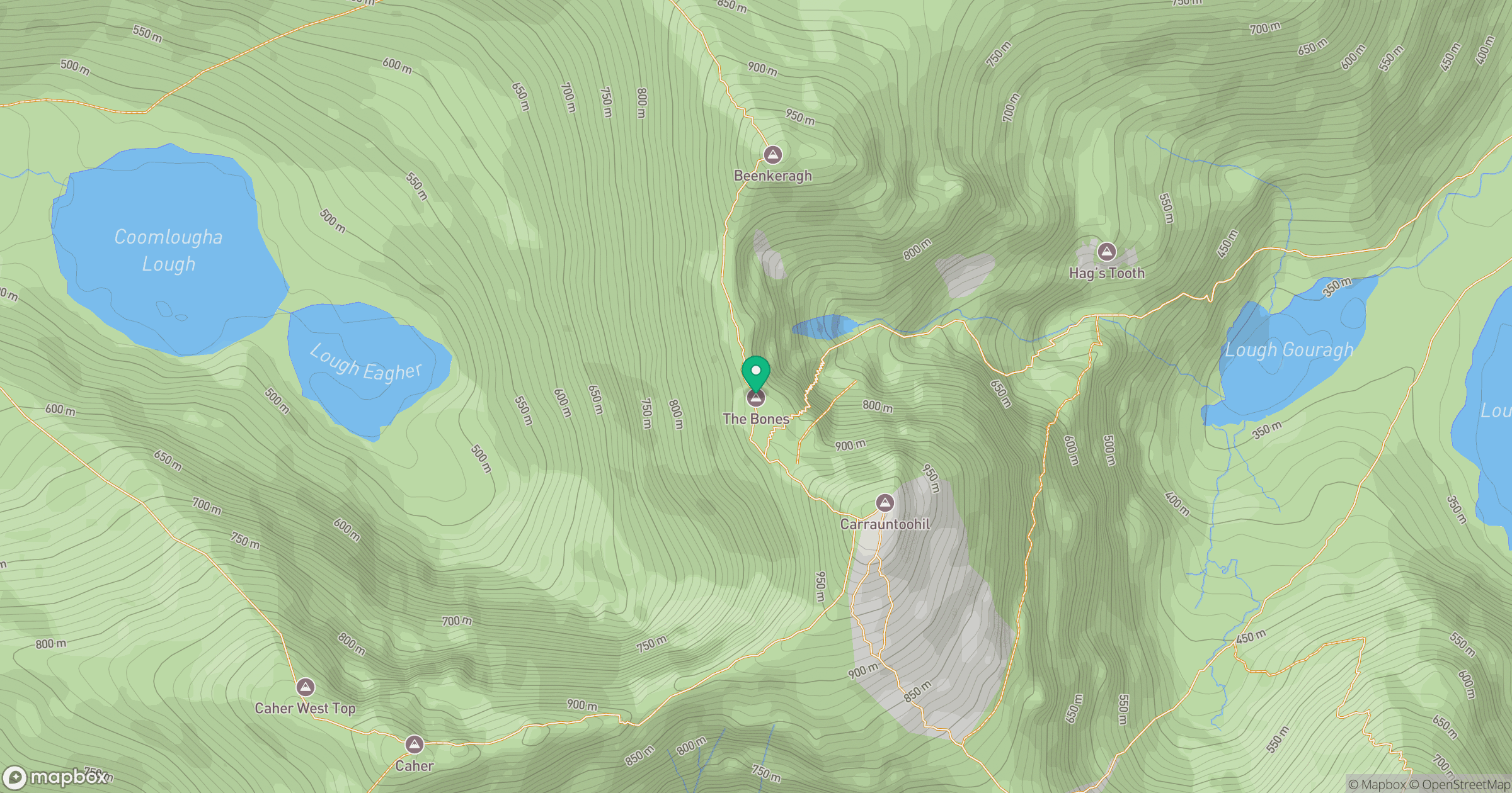
Grid reference: V800846
View on OpenStreetMapOpens a map in a new tab, centred on the hill.
Hills within 30 km
Straight-line distance, not a walking route or confirmation of access.
Carrauntoohil
1,039m
Torc Mountain
535m
Caherconree
834m
Broaghnabinnia [Bruach na Binne]
744m
Stumpa Duloigh
782m
No comments yet. Be the first.